
Chemistry Maps
ESdat is able to show chemistry results as a series of moveable labels on a background of Bing Maps or published WFS / WMS layers.
Chemistry Maps can be accessed under either Data View or Lab Results.
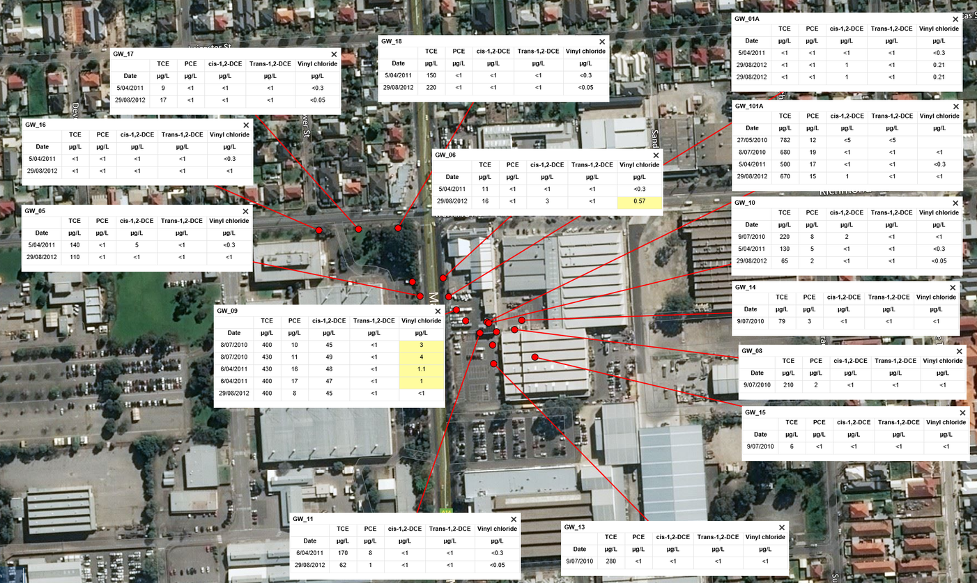
To use this functionality users will need to assign Locations with co-ordinates to their Chemistry Samples.
All the menu options available for Chemistry Tables are still available, and work identically; except the addition of a Points & Labels menu, and GIS specific export options.
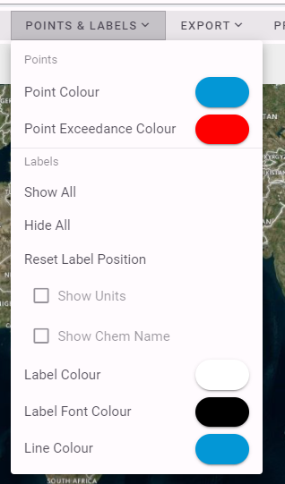
The above menu allows users to color the point representing the Location to indicate the presence or absence of an Exceedance
Labels show a small Chemistry Table for each location. To save space on the labels the Analytes are referred to by their Abbreviation, which can be set in the Chem Profile menu. Units are also hidden by default for the same reason. Users can select to use the full Chem Name and to show units if needed.
The Export menu provides for generation of a KML file for viewing locations in ArcGIS or other GIS applications. The chemistry result tables for each location are exported as png / image files and can be added as Annotation Layers in ArcGIS (ArcGIS doesn't support tables or background shading in it's labels).