
Project Data Completeness Checker
The Project Data Completeness Checker will look for common data gaps or incomplete data and can be used for:
- Internal QA/QC processes, and
- To ensure data is complete before sending a copy to other data users (eg sending an EDIF to a client).
Checks that are conducted are:
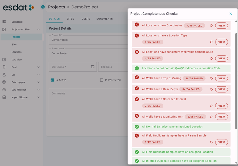
- Site(s) have a coordinate system specified.
- All Locations have Coordinates
- All Locations have a Location Type
- All Locations have consistent Well value Nomenclature:
For example well values “A”,B”,”C” would be consistent, but “A” and “-“ or “BH1B” would be inconsistent. - Locations do not contain QA/QC indicators in the Locatoin Code:
For example if a Location is called “QA1” it is likely that an incorrect Location has been created from a QA Sample Field ID. - All Wells have a Top of Casing
- All Wells have a Base Depth
- All Wells have a Screened Interval
- All Wells have a Monitoring Unit
- All Normal Samples have an assigned Location
- All Field Duplicate Samples have a Parent Sample
- All Field Duplicate Samples have an assigned Location
- All Interlab Duplicate Samples have a Parent Sample
- All Interlab Duplicate Samples have an assigned Location
- Normal Samples do not contain QA/QC indicators in the Field ID:
For example if a Field ID is “QA1” it is likely the sample is a QA sample and so the Sample Type should be set accordingly. - All Samples have corresponding Chemistry Results:
Sometimes laboratories will report samples with no results. It is not necessarily an issue, but users should confirm. - All Borehole records have Geology Data:
It is not necessarily an issue if this is not the case, however in general it would be expected.
Any comments in relation to the Completeness Check can be saved in the Project Comments field under Project Details.